The things I do for a patch!
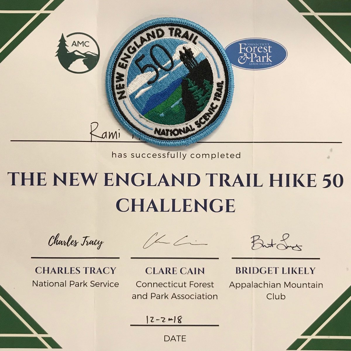
Started in 2018 to celebrate 50 years of NET by walking 50mi on the trail.
Returned in 2020 for two patches completing both 50 & 100 mile challenges.
I wanted to complete it in one day. Returned in 2021 to finish in 14 hours.
My choice was for Connecticut. Especially starting in Middletown (original Native American name Mattabesett). This Mattabesett–Menunkatuck section was my favorite:
- Weather resistant: none of the peaks was too high to be too cold.
- Fast terrain: run & walk fast in low elevation profile relative to remaining sections.
- Beach access: finish in Guilford on Long Island Sound for a dip in the salty water.
13 November 2021
It did not hurt to have another patch:

But the main reason I returned was to complete this challenge in one day on a beautiful trail, well maintained, & scenic. Even this late in the fall, there were still many yellow & red leaves to keep the day bright:
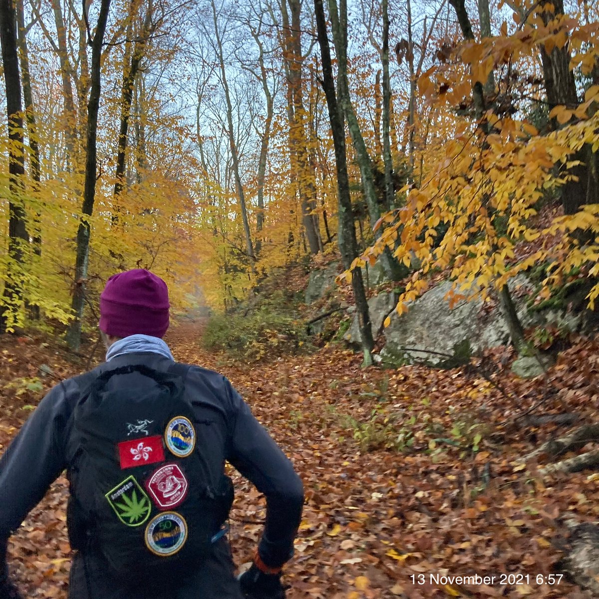
We had a beautiful start to the day with clear sky & cool temperature. Liza & Danny kept a fast pace—I only had to keep up or catch up. Except for two difficult turns to find, the signs were visible & trail easy to follow.
Stop at Krauszer’s Food Store at 32km was good timing: we were ready for fresh food & plenty of drinks. We took our time to adjust layers, tighten shoes, pack extra food, refill water, & prepare for a full stretch in the afternoon with no more stops.
The trail was easier in the second half with much less elevation gain than the first half. Then a thunderstorm came in the afternoon. Bright lightning was flashing in many directions. Loud thunder boomed in the distance. We kept running at low elevation between tall trees. Just as we finished wearing our rain jackets, gloves, & headlights, rain started. Heavy & cold. We ran to stay warm. An hour later, clear sky returned, the moon lit our path, & we were at the final stretch for the day.
No swim for me this evening: cold wind, cold body temperature still recovering from thunderstorm, & cold water while waiting for taxi to car at beginning of the trail were all high risk factors that I was not prepared to take. I returned the week after on a bicycle tour & a dip:

This run completed my goal for 1,000km in 2021.
Recorded 13 October 2021 4:12 on Garmin & Strava ➡️71.48km ⏩11:40/km 🔄13:53:44 ⬆️2,277.9m ⬇️2,296.5m ↗️32m/km 📶10.0ºC ⏬KML & GPX:

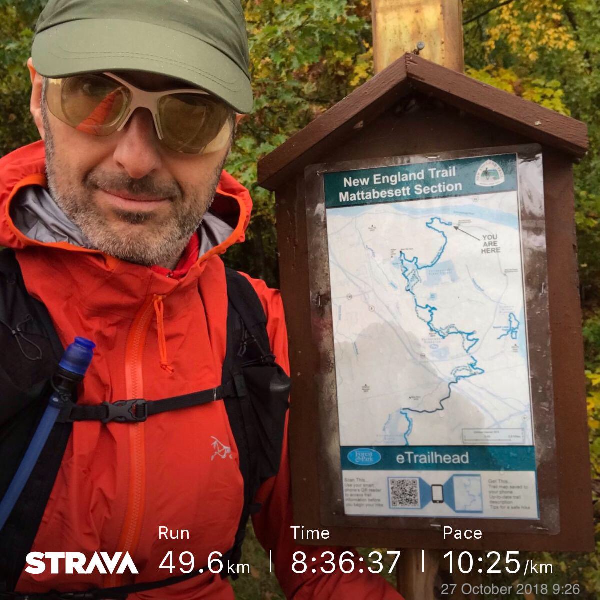
27 October 2018
When my friend Barbara first told me about this challenge in March 2018, I was intrigued. When I learned about the patch reward, then I was committed: hike 50 miles to celebrate 50 years of National Trails System.
The trail was scenic, well signed, & clear:

The New England National Scenic Trail is a 215-mile hiking trail route that has been in existence for over half a century. The NET travels through 41 communities in Connecticut and Massachusetts, and is comprised primarily of the historic Mattabesett, Metacomet, & Monadnock (M-M-M) Trail systems.
Travel
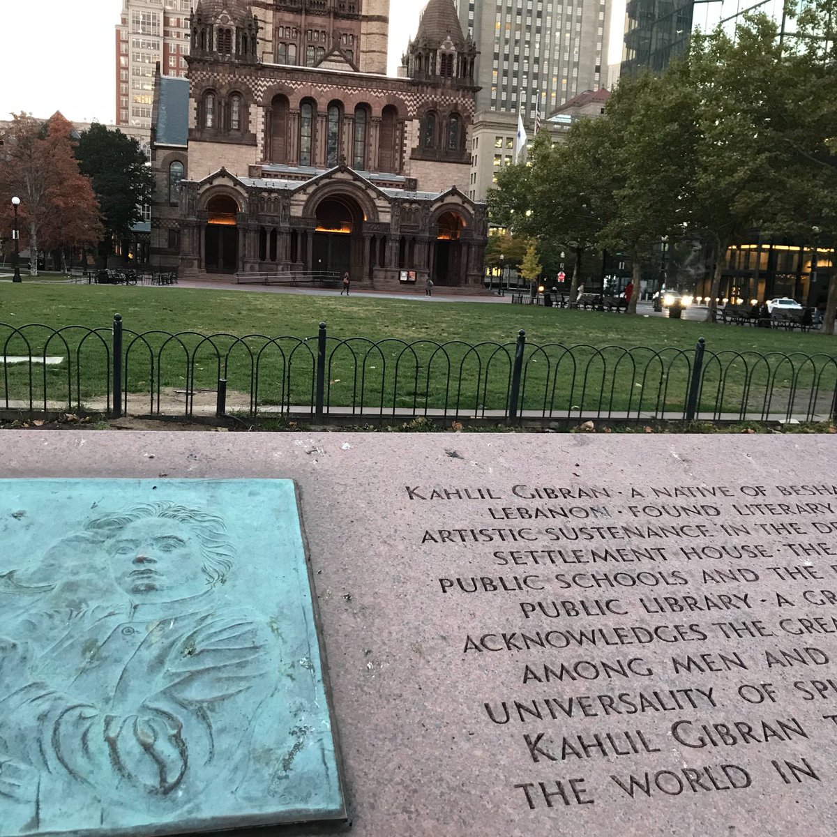
I ran out of time before my travel to Hong Kong in spring & summer. Then in October, I had a trip for one week in Boston, including a weekend.
“It was in my heart to help a little because I was helped much”
Kahlil Gibran plaque in front of Boston Public Library
That was my chance. Hike the 50 miles rain or shine.
I drove Friday afternoon to avoid traffic leaving Boston, pack, rest, & sleep early for a long hike next day.
Nor’easter
The weather forecast for Saturday was getting worse by the hour. I adjusted the trail to start in Middletown going southwest to Guilford, which meant the strong wind & rain were at my back.
Beth, the innkeeper, prepared basic breakfast of cake, orange juice, apple butter, & granola to fuel the hike. Then I ordered a taxi to trailhead in Middletown:
I started slow to adjust layers multiple times to keep dry from the rain, but not too hot to sweat. I finally settled on the rain jacket as my only top layer, with shorts & rain pants for bottom layers.
Trail blazes were frequent, ground was clear from rocks & roots, & navigation was quick. I picked up the pace with occasional stop to read map or validate location.
I had two food stops in mind. The first at 16km Deb’s Restaurant which I skipped. Breakfast was keeping me going, & I had extra food in my backpack. The second stop was at 34km Krauszer’s Food Store. By then, I was cold, hungry, & shivering. I stopped there to eat & change layers: gloves, shirt, & hat. That shop owner was not very welcoming or pleased with my extra stay.
The trail here had been diverted from the published paper map to avoid walking on road. Instead, I just followed the trail signs. Then the sun set & got completely dark. No trouble though navigating with a headlight all the back to my room.
Beach
This was going to be a great day: dry weather, cool temperature, flat terrain, mostly downhill, all the way to the beach for a splash in Long Island Sound:

The trail was still high quality & easy to navigate. Even without any major elevation, the scenery was still beautiful through small hills & open meadows.
The final 5km were on the road through quaint town of Guildford: town green, shopping, plenty of restaurant options, & train station.
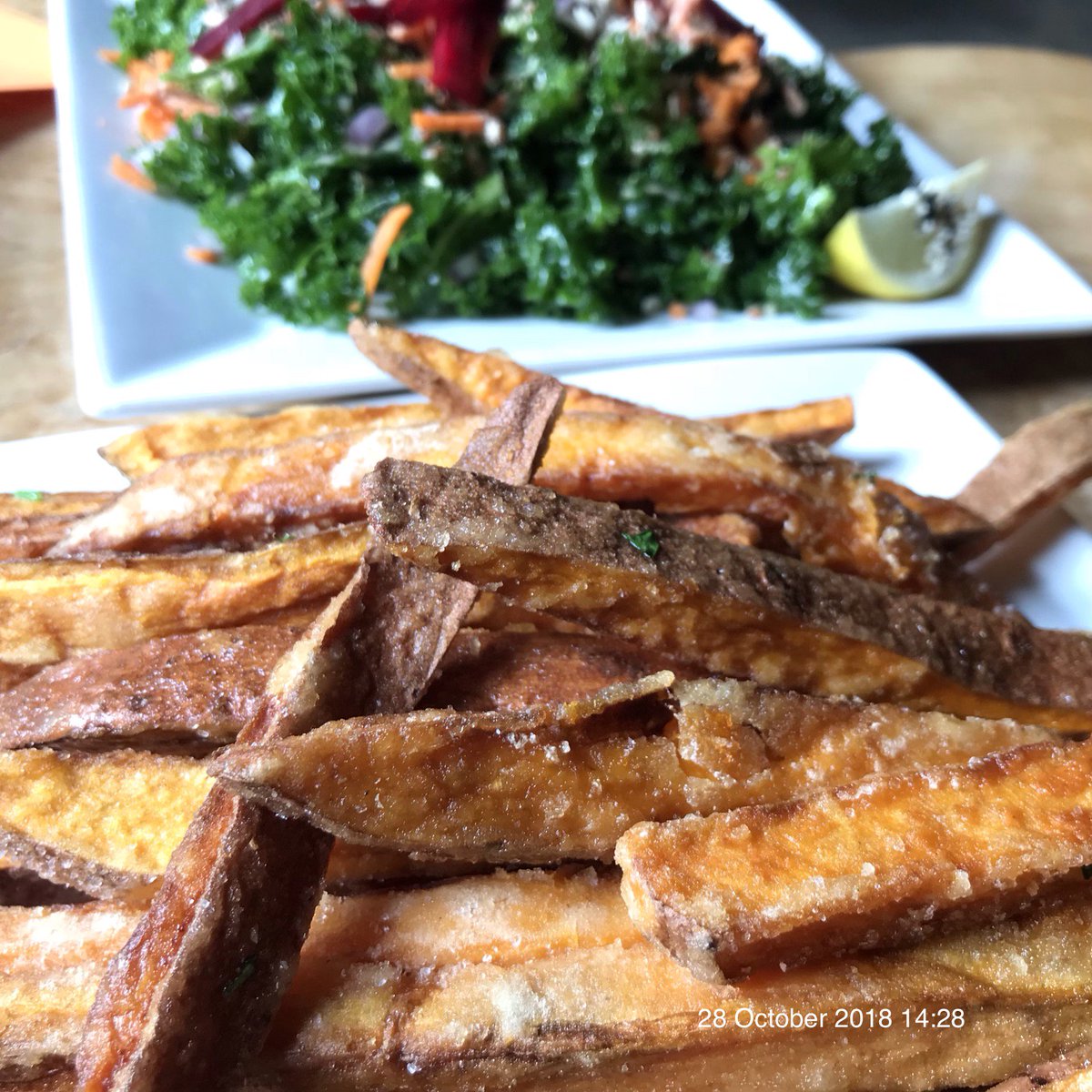
Reward
After a quick frigid dip, I put on dry clothes, took a taxi back to my room, & drove to It’s Only Natural restaurant in Middletown for sweet potato fries:
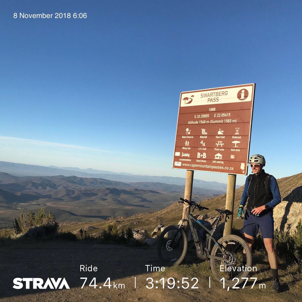
I returned to Boston for work until Wednesday night. Then took long flight BOS–FRA–JNB–PTE to start an bicycle tour in South Africa:
Route
Lodging was at an Airbnb property directly on the trail for easy access on both days.
27 October 2018 9:27 on Garmin & Suunto & Strava ➡️49.13km ⏩12:15/km 🔄10:01:30 ⬆️1,822m ⬇️1,678 ↗️37.1m/km 📶8.6ºC ⏬KML & GPX:

28 October 2018 7:48 on Garmin & Suunto & Strava ➡️28.97km ⏩11:12/km 🔄5:24:50 ⬆️487m ⬇️576m ↗️16.8m/km 📶8.5ºC ⏬KML & GPX:

Total ➡️78.10km ⏩11:52/km 🔄15:26:20 ⬆️2,309m ⬇️2,254m ↗️29.6m/km 📶8.6ºC.
Pack
- Running vest: Arc’teryx Norvan 14. Carry water, clothing layers, food, phone, & other accessories. It was very comfortable & stable, with plenty of accessible pockets in front to use while on the run. The vest does not have a good pocket to carry poles, but that did not matter on this hike, since I did not have poles.
- Water bladder, 2l inside hydration vest, sufficient on cold day.
- Electrolyte pills: Hammer Nutrition Endurolytes. Consumed close to 10 capsules, helped to recover electrolytes throughout the day. I carry them in small container.
- Headlight: Black Diamond Storm. Long lasting on four AAA batteries, waterproof, used for the last two hours in the dark.
- Shell jacket for rain & wind: Arc’teryx Norvan. Used it all of first day to protect from rain & cold. At first, I did not have anything underneath it, until late in afternoon when it got cold, I added a shirt.
- Shell pants for rain & wind: Arc’teryx Beta. Used it all of first day to protect from rain & cold. Wore running shorts underneath.
- Phone, ID, & credit card in vest pockets. Luckily, the iPhone 7 was waterproof in the rain on first day.
- Whistle
- Temperature sensor: Garmin Tempe. Measures the temperature away from ambient heat, sun light, or other factors. I clipped it to a vest strap.
- Me
- Trail running shoes, Salomon.
- Waterproof socks: Sealskins. Would not have completed this trip without them. My feet stayed warm the entire day. I used them both days, even when it was not raining, because the ground was still wet. Dry warm feet were guaranteed.
- Toe socks: Injinji Ultra Run No-Show Socks. Wore under waterproof socks to reduce friction & blisters.
- Sunglasses: Julbo.
- Gloves, waterproof, two pairs. Changed half way during the first day into a dry pair.
- GPS watch
- Heart rate monitor: Wahoo Tickr. Broadcasts in both Bluetooth & ANT+ to work with multiple GPS devices.
- Missed: bandana. The one item I missed having was some cotton cloth to dry the phone screen with. In the rain, it was impossible to handle a wet touch screen. I had nothing to dry it off with. Everything was soaked.
- Home: I decided leave a few items behind on purpose to stay light given current conditions.
- Poles: terrain was comfortable with many rolling hills, but no steep mountains or rocky steps.
- USB battery: this was a risk. I never want to run out of battery. I should have brought at least a small USB battery for phone emergency. Instead, I kept the phone on airplane & low battery modes all day.
- Sun hat: forecast was for rain & clouds. Used a hoodie instead for warmth.
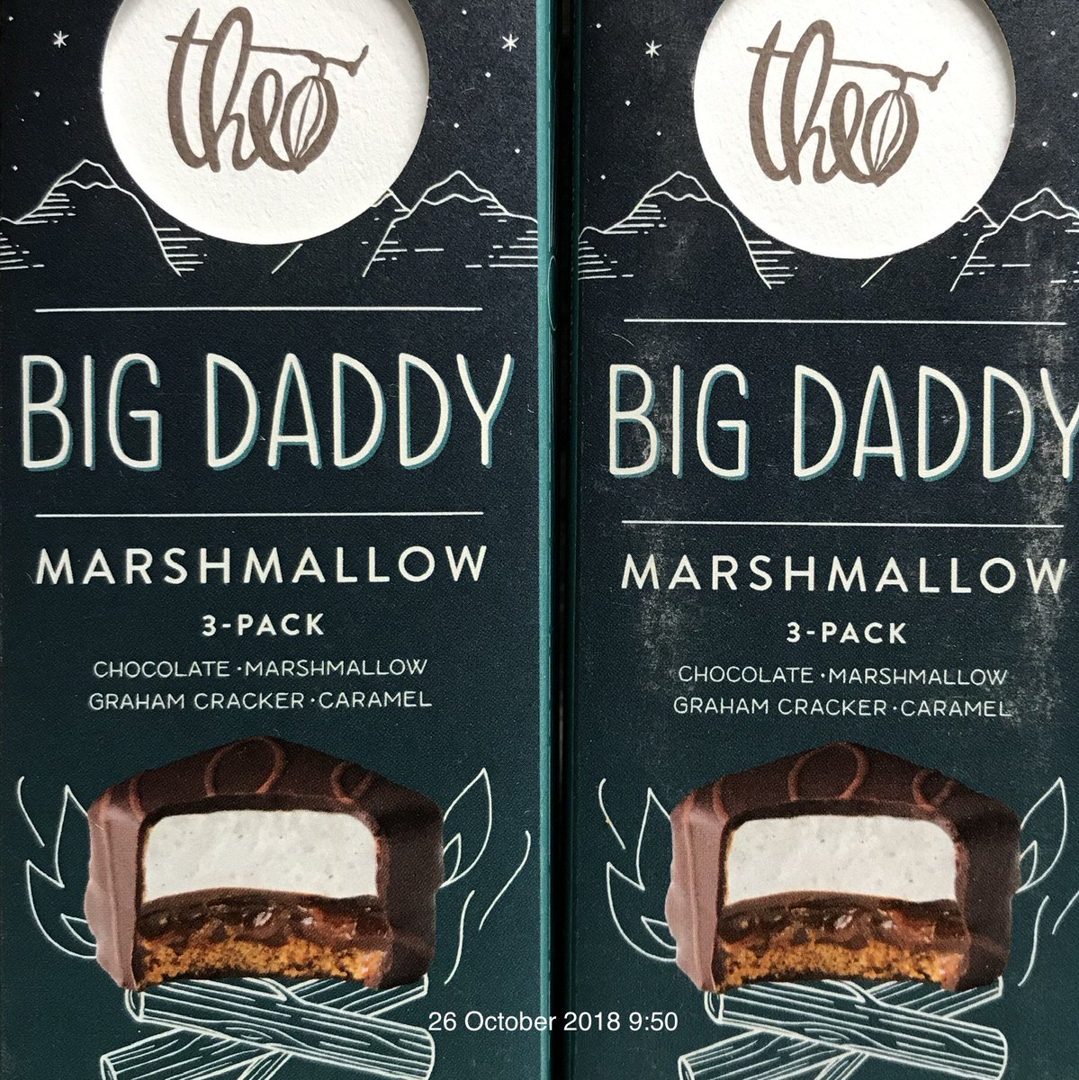
- Snacks: I had a collection that I ate throughout the weekend.
- Theo Chocolate Big Daddy Marshmallow
- Skratch Labs Anytime Energy Bar
- Redd Superfood Energy Bar
- Wild Zora Original Meat & Veggie Bar
- Oberto Trail Mix with Jerky

Leave a comment